Contour lines from the point cloud – ready for CAD
Contour lines on round elevations are created from the terrain model. You check them on screen, limit them to your site and pass them on as DXF – compact or as 3D polyline.
The problem: lines that are unwieldy in CAD
Contour lines from large terrain models quickly turn into huge files that open sluggishly in CAD. So you decide on spacing, smoothing, area and format before the export, and you see what comes out.
How it works
Build the terrain model (DEM) and limit it
Contour lines are calculated from the DEM; without a DEM the section stays hidden in the DEM panel. “Build DEM” computes a height grid from the ground points of the analysis-active cloud. The “Auto” filter uses classification 2 if present, otherwise the lowest point per cell. If the cloud carries ground class 2, the option “Class filter – ground only” appears (on by default).
If an area is marked as boundary, the option “Limit to boundary” appears (on by default): the DEM is then built only inside that area, and the contour lines end there too.
Generate the lines
In the “Contour lines” section you set the interval, the index interval (the heavily drawn lines), the minimum length for short fragments and the label spacing, each in the selected unit (m, ft, US ft). “Generate/Update” calculates the lines and shows them in the viewport. The status line gives the number of lines and how many were filtered out as too short. If the spacing would create too many line pieces (over 3 million), nothing is calculated and the message names the smallest suitable spacing.
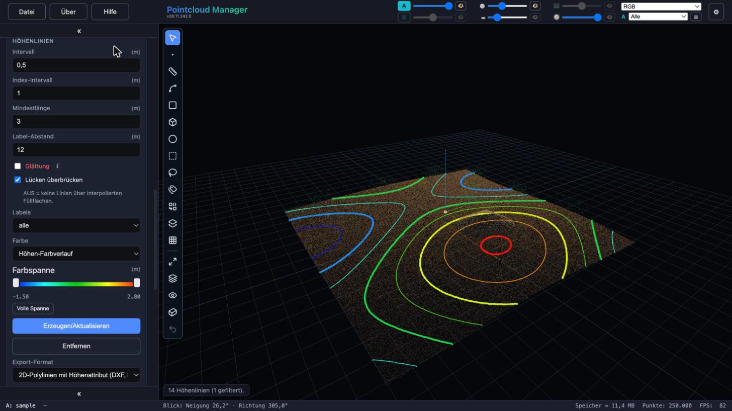
Contour lines section with interval, index interval, minimum length, label spacing, smoothing, color and export. Sample data, German interface. Smooth, label, color
Smoothing (two Chaikin passes, off by default) rounds off the stair-step course; the status line states the maximum deviation from the unsmoothed course. Labels can appear on index lines only, on all lines or not at all. “Bridge gaps” lets the lines run continuously across areas where the DEM has interpolated holes; switched off, they break there and you see where real measurement data is missing.
The “Elevation ramp” puts the DEM height ramp on the lines. A two-handle slider stretches it to a freely chosen height range, and recoloring happens instantly without recalculation. The colors are display only – the DXF export stays layer-colored.
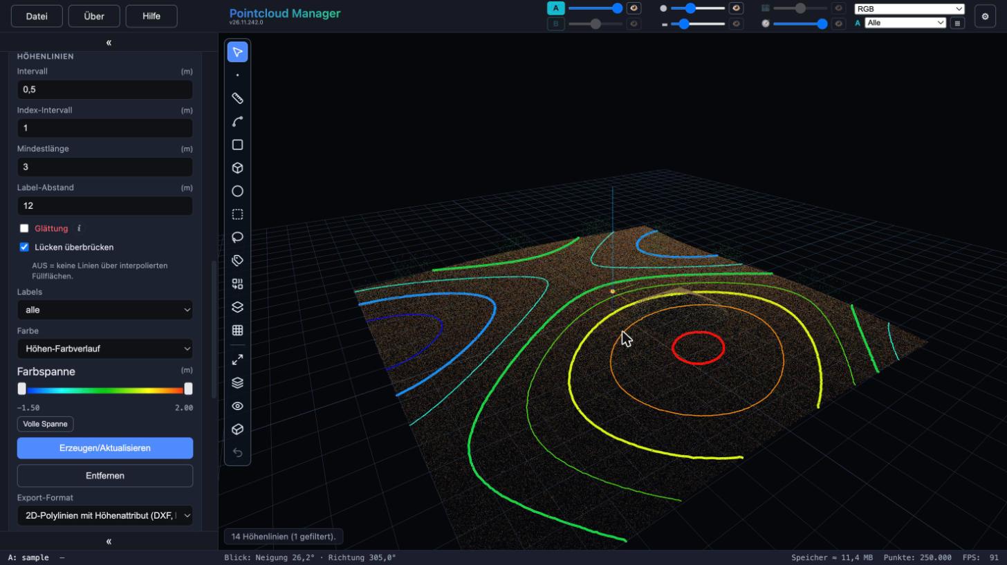
Contour lines with a height color ramp, thick index lines and thin intermediate lines over the point cloud. Sample data, German interface. Export as DXF
“Export” writes the displayed lines in the chosen format: as DXF with 2D polylines and an elevation attribute (compact) or with real 3D polylines, optionally with 3D points at all vertices as well. Normal lines, index lines, labels and points are on separate layers. For volume calculations in CAD there are three formats that write only 3D points: DXF points, an XYZ file or a CSV file, each rounded to the millimeter.
The 3D polyline carries no additional information because a contour line has the same height everywhere – it only makes the file larger. For deliveries the 2D polyline is recommended.
Result
Contour lines on round elevations, separated onto layers into normal and index lines, within the area of your boundary. To compare file sizes, the example from the manual (dyke terrain, 845 × 541 m, DEM 0.4 m, spacing 0.1 m, 1.34 million points, without smoothing):
| Format | File size |
|---|---|
| DXF, 2D polyline with elevation | about 55 MB |
| DXF, 3D polyline | about 180 MB |
| 3D points only as DXF | about 150 MB |
| 3D points only as XYZ or CSV | about 40 MB |
Limits
- Without a DEM there are no contour lines. The lines follow the terrain model’s grid; without smoothing the course is stair-stepped.
- With smoothing four times as many points are created and the files grow accordingly (in the example about 210 MB for the 2D polyline). The smoothed points no longer lie exactly at their elevation – for exports that are used for calculations, leave smoothing off.
- CAD programs hold every vertex as an object of its own. Files of a few hundred MB open slowly or not at all. For deliveries: choose a coarser spacing, crop with a boundary or section box and split large areas into several files.
- Point clouds do not belong in DXF – use LAS or LAZ for that.
More in the manual
The complete description of the functions used is in the manual:
Status: app version 26.11.242.0
More features
Work with your own point cloud.
Open point clouds, trace existing features and export geometry for CAD — directly in your browser, with point cloud data processed locally.
Try free for 14 daysRequest a demo