Compare and register point clouds
Two epochs, drone versus laser scan, as-planned versus as-built: Pointcloud Manager holds two clouds in slots at the same time, overlays them and aligns the movable one to the reference.
The problem: two clouds that do not match
To compare two point clouds you need both in view at once and in the same coordinate frame. If they are shifted, rotated or slightly tilted against each other, they must be registered first before any comparison means anything.
How it works
Load two clouds into slots
On the second import a dialog asks: “Load into slot B” (for comparison or alignment) or “Merge into slot A” (classic merge). Slot A is the movable cloud by default, slot B the reference; the roles can be swapped via dropdown at any time.
Visibility, color source, opacity and role are set separately for each slot. That lets you lay a half-transparent cloud over the other or switch between them. You can also load the same point cloud into both slots and show it in two color sources, for example slot A in RGB and slot B by intensity or classes, overlaid or alternating. The “analysis active” radio button decides which slot the measuring, classification and section box tools act on. Official open-data LiDAR can serve as the reference too: next to a loaded cloud it goes into slot B without asking.
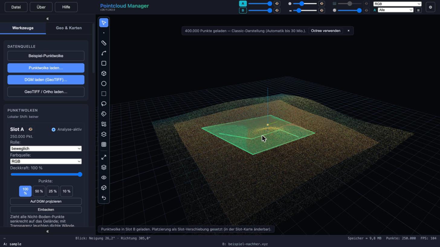
Two point clouds in slot A and slot B shown together in the viewer, A/B switch at the top. Sample data, German interface. Align roughly
“Align” shows the gizmo at the center of the movable cloud, with the X, Y, Z axes and the XY, ZY, ZX plane handles. X, Y, Z lock the drag to one axis; Ctrl clamps a plane drag to the dominant 90° component. Esc leaves the tool; the shift that has not been baked stays and can be edited later.
Register with two points
With “Reference align” you click two points on the cloud (anchor and handle) and then drag the gizmo. Reference align rotates about the viewing axis and needs the orthographic view. “Reference tilt” tilts about a horizontal axis through the anchor point.
A running session can be converted with “→ Tilt” or “→ Align” in the control bar without clicking the line again. The app remembers the last applied line per slot; “New line” discards it. “Lock scale (rotate only)” keeps the scale fixed and is active by default.
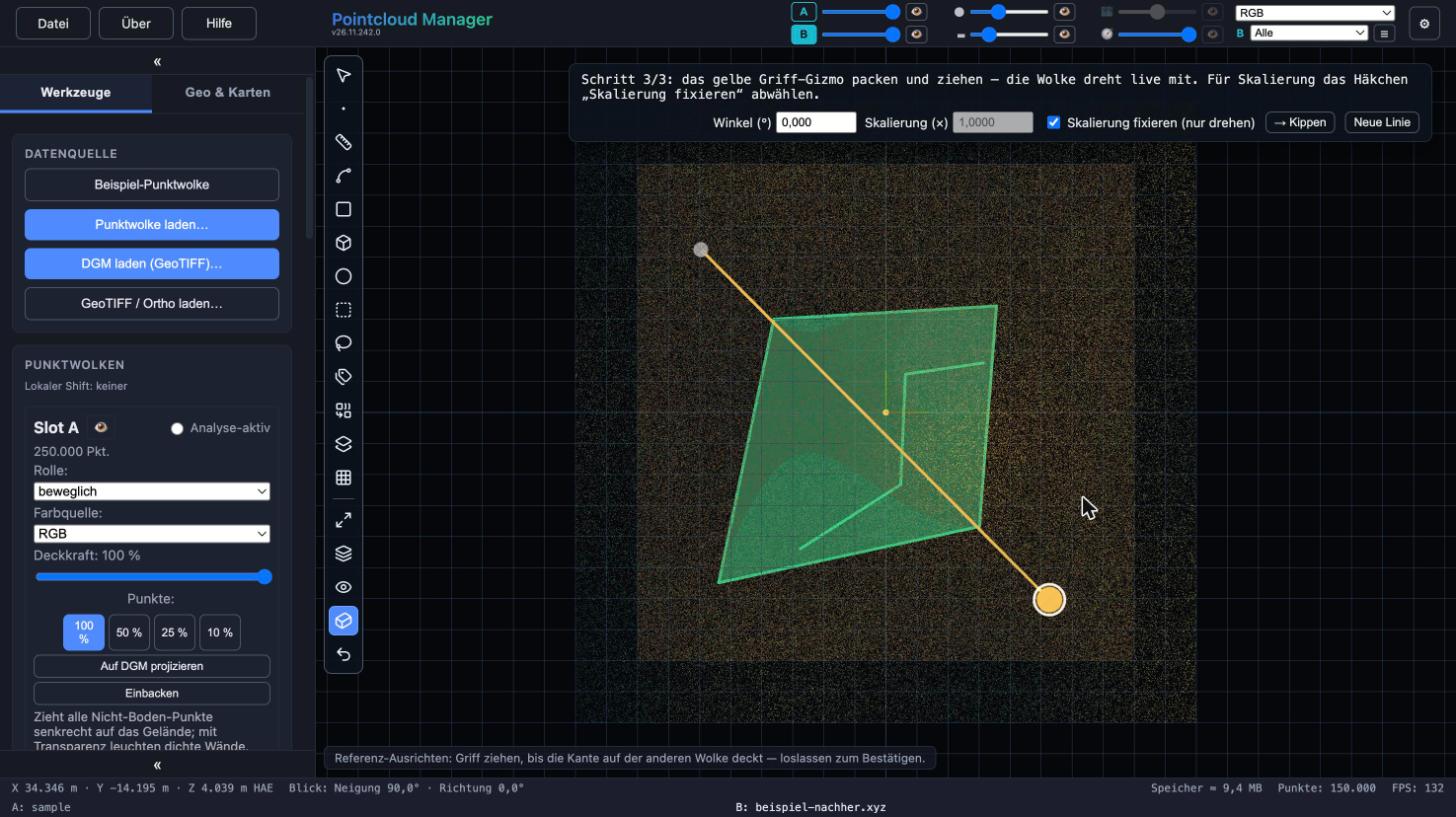
Reference alignment from above with line, handle and control bar for angle and scale. Sample data, German interface. Fine-tune and type values
While dragging, Shift reduces sensitivity to one tenth; Alt snaps to round values (height difference and distance to 1 mm, rotation angle to 0.1°). Both act immediately, even mid-drag, and can be combined.
Angle, Δh (tilt only) and scale can also be entered directly as numbers. This works even where the handle cannot be grabbed because of the viewing angle. A value that cannot be accepted is rejected with a reason in the status line.
Bake and merge
“Bake” writes the shift permanently into the slot’s point data; both clouds stay separate. “Bake & merge” bakes first and then merges both into a single cloud. When exporting LAS the app applies an alignment that is still open, so baking is not required for that.
Several resolution levels of the same survey can be aligned identically too: load the cloud in the highest resolution, align it, save the project, then pick the next variant in the project instead of the original file – the saved alignment is applied to the new file.
Result
Both clouds sit in the same frame. You compare them visually via opacity, color source and switching; numerically you compare them with the Volume A/B tool (see “Volume from point clouds”).
Limits
- The alignment comes from the points you click and the numbers you enter. The app does not search for the best match on its own.
- Reference align needs the orthographic view, and reference tilt needs a viewing direction from which the handle can be grabbed; numeric input works around that.
- A shift or alignment that is still open restricts some follow-up steps: a terrain model from such a slot is refused for Volume A/B, and the lasso then deletes but does not fill. Bake first.
- Two surfaces in different coordinate frames cannot be compared in Volume A/B; the card then gives the reason.
More in the manual
The complete description of the functions used is in the manual:
Status: app version 26.11.242.0
More features
Work with your own point cloud.
Open point clouds, trace existing features and export geometry for CAD — directly in your browser, with point cloud data processed locally.
Try free for 14 daysRequest a demo