Prepare point clouds and export them lean
Not every scan belongs in the delivery in full. Crop, thin, merge and compress losslessly before the file goes on – right in the browser.
The problem: files larger than the job needs
Scans usually contain more than the assignment asks for: surroundings outside the site, overlaps of two acquisitions, a density the purpose does not need. That makes files large and handover slow. Pointcloud Manager reduces the cloud to what is needed – either permanently in the loaded cloud or only in the export file.
How it works
Crop to a boundary area
Draw an area and mark it as boundary on the shape card. “Crop cloud” keeps only the points inside (all heights); “Cut hole” does the opposite, removing the points inside and keeping everything outside. Both act permanently on the active slot, ask for confirmation showing the point counts and cannot be undone. Points exactly on the edge belong to exactly one of the two sides.
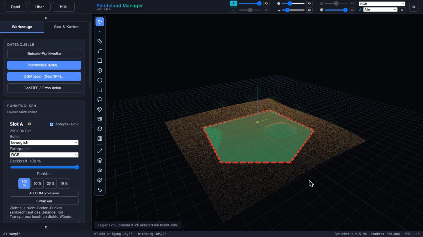
Area marked as boundary, dashed red, over the point cloud. Sample data, German interface. Limit with the section box
The section box hides spatial regions, either inside or outside. You drag it open in the viewport, move sides with the arrows and enter size, position and rotation as numbers in the panel. “Fit box” wraps it around the visible cloud; four memory slots store boxes in the project. “Delete hidden…” removes the hidden points permanently from the active slot – only the box decides there, not the class filter.
Alternatively the crop affects only the file: the export dialog has the options “Crop to section box” and “Crop to boundary”. Cloud and display stay unchanged.
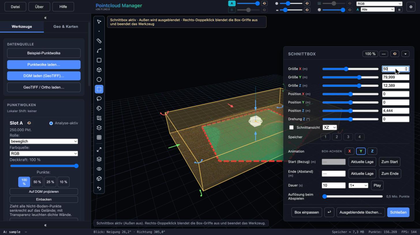
Section box with frame and handles in the viewport and panel with size, position and rotation. Sample data, German interface. Reduce the resolution
In the export dialog you thin the cloud to a target point spacing. Alongside cropping and LAZ compression, that is how you make an export smaller; which spacing suits the purpose is your call.
Merge two clouds
If two clouds are loaded, both are merged on export – before the section box and boundary crop and before thinning. The order is therefore: merge, section box, boundary, thinning. This temporarily needs the space of both clouds.
Choose the format and export
Export as LAS 1.2 (point format 3) or LAS 1.4 (point format 6/7). The “Compressed as LAZ (lossless)” option is on by default and compresses in the browser; the format line shows version, point format and a size estimate of about 12–30 % of the uncompressed size. Progress and a cancel button appear in the status line. If compression fails, the app does not silently write an uncompressed file but reports it.
For further processing, for example in Gaussian splat tools, there is also PLY export (binary, with colors, in world coordinates). File → “Compress LAS → LAZ…” compresses an existing .las file from disk byte for byte without loading it into the app.
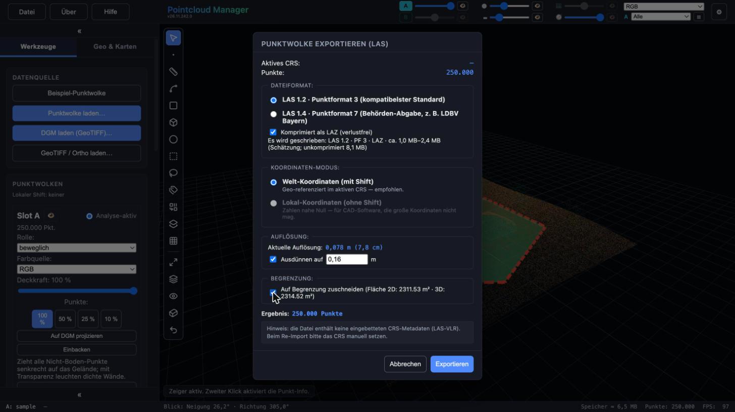
Export dialog for LAS and LAZ with LAZ compression, thinning and cropping to the boundary. Sample data, German interface.
Result
A file that contains only what is to be handed over – at the density the purpose requires. As a rule of thumb LAS 1.2 needs 34 bytes per point (100 million points about 3.2 GB); lossless LAZ is about 12–30 % of that. LAS is written in chunks of 4 million points, so the size is limited only by memory and disk.
Limits
- The class filter does not act on LAS export: classes you have hidden still go into the file. The export can be limited via section box, boundary and thinning.
- The “Compress LAS → LAZ” tool rejects files that are already compressed, point format 4/5 and LAS 1.3 with embedded waveform data. It is designed for files above 2 GiB; measurements go up to 375 MB.
- A cloud holds at most 178,956,970 points. For larger uncompressed .las files the app offers thinning before loading.
- Cropping and deleting in the loaded cloud does not change the original file; project files do not contain clouds. An edited state only persists through export.
More in the manual
The complete description of the functions used is in the manual:
- Section box
- Vector editing
- LAS export: LAZ compression
- Memory and file size limits
- COLMAP points and PLY export
Status: app version 26.11.242.0
More features
Work with your own point cloud.
Open point clouds, trace existing features and export geometry for CAD — directly in your browser, with point cloud data processed locally.
Try free for 14 daysRequest a demo